TA9191

Critical Infrastructure

The TA9191 geospatial database provides a web-based Geospatial Information System (GIS) platform for visualizing existing critical infrastructure and climate change projections to support planning, investment, and development of resilient infrastructure in the energy, transport, and water sectors across South Asia and Southeast Asia. The web-based platform allows users to interact with critical infrastructure and climate change data to better understand how climate change affects critical infrastructure assets and complexes.

Climate change projections for temperature and precipitation can be selected and overlain with energy, transport, and water sector infrastructure data in the map viewer. Separate climate data layers are available for South Asia, Southeast Asia, Indonesia, Sri Lanka, and Viet Nam, reflecting the individual models selected for each spatial extent. The data can be selected for season (either wet/dry or northeast/southwest monsoon) and is available for both RCPs 4.5 and RCP 8.5. Climate change projections can be viewed as a continuous data set, or as "hot spot" data, where the data is divided into quintiles to highlight those areas projected to experience the highest relative changes.

By allowing users to spatially visualise impacts, users can also see how climate and other hazards can have external or result in a causal sequence of events to impact infrastructure even if the hot spot is located away from that infrastructure, and to facilitate landscape-scale planning through the visualization of spatial data at the regional, national, and catchment scales. In addition, selected infrastructure records are available in searchable tabular format as part of the data inventory.


GIS MAP VIEWER

The GIS Map Viewer provides interactive functionality where spatial layers of critical infrastructure assets are viewable in the context of climate change and climate change-related hazard data. This facilitates an increased understanding of the distribution of assets and the extent to which those assets will be impacted by the extreme scenarios of climate change analyzed through this project. The GIS Map Viewer allows users to select regional or national CI data by sub-category of each sector - for example oil refineries in the energy sector or sanitation facilities in the water sector and to overlay on climate change hotpot categories of temperature and precipitation changes.


DATA INVENTORY

The Data Inventory contains detailed information about the critical infrastructure, such as the capacity and year constructed. The Data Inventory also presents useful statistics such as total capacity by region or country, and allows users to sort through data by infrastructure sector, sub-category, and location.


METADATA CATALOGUE

The Metadata Catalogue displays an interactive and searchable metadata catalogue showing key metadata elements as a table. Metadata are captured using the international geographic metadata standard ISO19115 with records exportable in this format for importing to other external metadata applications.

The development of this database was made possible through the support of the Asian Development Bank, and was developed in partnership with the Asian Disaster Preparedness Center. The following government partners supported data collection and the development of this platform:

- Indonesia: BAPPENAS - Bandan Perencanaan dan Pembangunan Nasional (Ministry of National Development Planning of the Republic of Indonesia)

- Sri Lanka: Ministry of Power and Energy

- Viet Nam: ISPONRE - Institute of Strategy and Policy on Natural Resources of Environment, under the Ministry of Natural Resources and Environment

Loading ...


Data Inventory


Metadata Catalogue

TA9191 critical infrastructure datasets


ABOUT TA9191

Critical Infrastructure

This Geospatial Database is part of a technical assistance project the Asian Development Bank (ADB) is implementing, “Building Climate Change Resilience in Asia’s Critical Infrastructure.” This is a joint venture project between the International Centre for Environmental Management (ICEM), the Asian Disaster Preparedness Center (ADPC), and Philkoei International to address emerging development challenges identified in ADB’s long term corporate strategy through the promotion of infrastructure investments that are green, sustainable, and climate resilient (ADB, 2018). The main project objectives are to enhance the knowledge base on climate change risks to critical infrastructure in South and Southeast Asia and to build a better understanding of necessary actions and innovations for climate change resilient critical infrastructure.


PROJECT GEOGRAPHICAL SCOPE

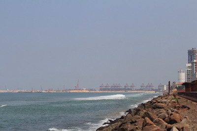
The Geospatial Database focuses specifically on the infrastructure and vulnerability assessment of infrastructure at the regional scale and within the three pilot countries selected for this project - Indonesia, Sri Lanka, and Viet Nam. The regional database contains only infrastructure that is defined as “large or extensive enough to be critical for two or more Asian countries and/or important in regional trade, and where disruption or destruction would have a significant impact on at least two Asian countries” (ICEM, 2019). The national database include all assets which are defined as “infrastructure of strategic importance to a nation – infrastructure which does not meet the regional-scale standard but is critical in its national context” (ICEM, 2019).

PROJECT SECTORS

The project focuses on three key sectors of critical infrastructure – energy, transport, and water – with assessments undertaken at regional, national, and case study (catchment) scales. The infrastructure assets and systems contained in the database have been gathered from primary and secondary sources and compiled by experts in water, transport, and energy sectors. Inventories have been confirmed with national representatives where possible, and all available information about each asset has been included in the inventory, such as capacity and year of construction, but data was not available for all assets. The database is intended to be continually updated as new information becomes available and new infrastructure assets are planned or completed.
ENERGY

Energy

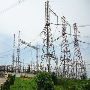
Oil ports, Oil productions, gas, transmission line, substation

WATER

Water

Dikes, barries, dams
TRANSPORTATION

Transportation

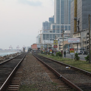
Roads

CLIMATE CHANGE PROJECTIONS

The climate change projections developed under this project are intended to represent possible extreme scenarios under RCPs 4.5 and 8.5. Two models were selected to represent each of these cases at the regional (South and Southeast Asia) and national (Indonesia, Sri Lanka, Viet Nam) levels. These models represent plausible changes to precipitation and temperature which result in the wettest and driest outcomes at national and regional scales. Further analysis was done to look at the potential threats to critical infrastructure posed by extreme events, using data from historical (including recent) extreme events.